 Coming for the New Year: Learning Opportunities with LITA
LITA will have multiple learning opportunities available over the upcoming year. Including hot topics to keep your brain warm over the winter. Starting off with:
Getting Started with GIS (Geographic Information Systems)
Instructor: Eva Dodsworth, University of Waterloo
Offered: January 12 – February 9, 2015, with asynchronous weekly lectures, tutorials, assignments, and group discussion. There will be one 80 minute lecture to view each week, along with two tutorials and one assignment that will take 1-3 hours to complete, depending on the student. Moodle login info will be sent to registrants the week prior to the start date.
WebCourse Costs: LITA Member: $135 ALA Member: $195 Non-member: $260
Register Online, page arranged by session date (login required)
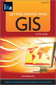
Getting Started with GIS is a three week course modeled on Eva Dodsworth’s LITA Guide of the same name. The course provides an introduction to Geographic Information Systems (GIS) in libraries. Through hands on exercises, discussions and recorded lectures, students will acquire skills in using GIS software programs, social mapping tools, map making, digitizing, and researching for geospatial data. This three week course provides introductory GIS skills that will prove beneficial in any library or information resource position.
No previous mapping or GIS experience is necessary. Some of the mapping applications covered include:
- Introduction to Cartography and Map Making
- Online Maps
- Google Earth
- KML and GIS files
- ArcGIS Online and Story Mapping
- Brief introduction to desktop GIS software
Participants will gain the following GIS skills:
- Knowledge of popular online mapping resources
- ability to create an online map
- an introduction to GIS, GIS software and GIS data
- an awareness of how other libraries are incorporating GIS technology into their library services and projects
Instructor: Eva Dodsworth is the Geospatial Data Services Librarian at the University of Waterloo Library where she is responsible for the provision of leadership and expertise in developing, delivering, and assessing geospatial data services and programs offered to members of the University of Waterloo community. Eva is also an online part-time GIS instructor at a number of Library School programs in North America.
Register Online, page arranged by session date (login required)
Don’t forget the final session in the series is coming up January 6, 2015. You can attend this final single session or register for the series and get the recordings of the previous two sessions on Web Mapping and OpenStreetMaps. Join LITA instructor Cecily Walker for:
Coding maps with Leaflet.js
Tuesday January 6, 2015, 1:00 pm – 2:00 pm Central Time
Instructor: Cecily Walker
Ready to make your own maps and go beyond a directory of locations? Add photos and text to your maps with Cecily as you learn to use the Leaflet JavaScript library.
Register Online, page arranged by session date (login required)
Webinar Costs: LITA Member $39 for the single session and $99 for the series.
Check out the series web page for all cost options.
Questions or Comments?
For all other questions or comments related to the course, contact LITA at (312) 280-4268 or Mark Beatty, mbeatty@ala.org.